Music is set to start automatically. If your browser blocks autoplay, click Music On once.
Site Navigation

Cave Dive World · country catalogue

Mexico

Quintana Roo giant systems · cenotes · aquifer science · archaeology · hydrothermal depth · exploration.

Cave Dive World banner

approved research integrated · v0.1

Great Mayan Aquifer • Cenotes • Sac Actun • Ox Bel Ha • Zacatón • Archaeology • Exploration Frontiers

Professional catalogue v0.1 — September 2026

Research and information catalogue. This page is not a dive guide and does not replace training, permissions, current access checks, local knowledge or expedition planning.

Mexico · research catalogue

National KCore identity - giant aquifer caves and hydrothermal depth

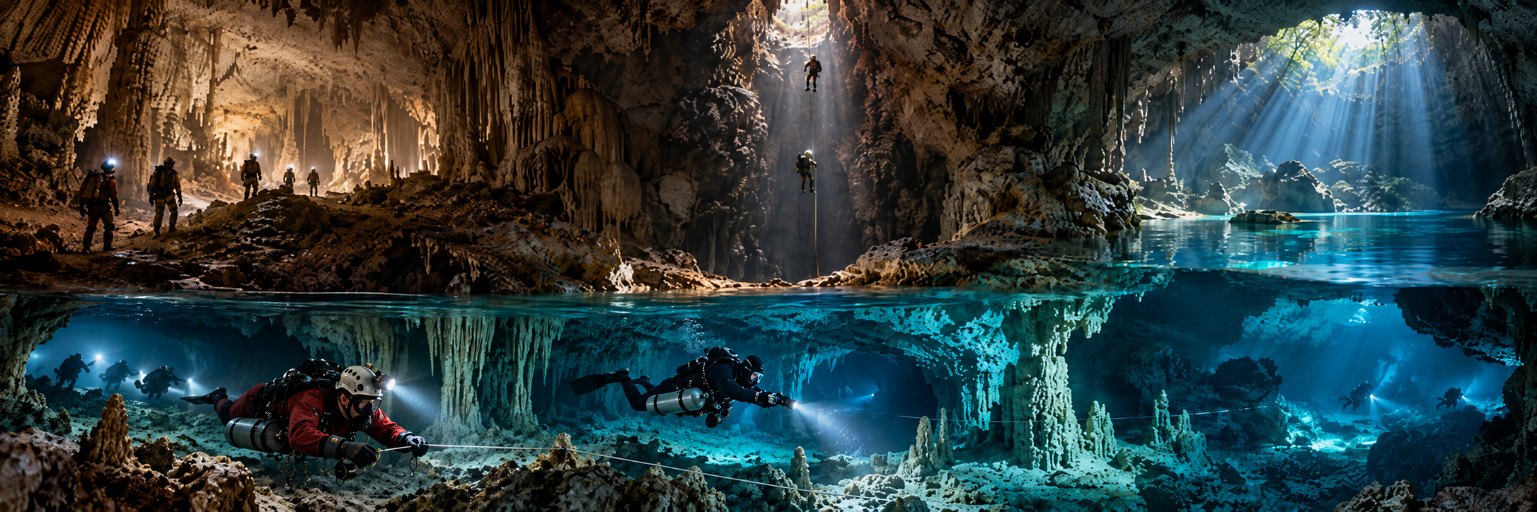
Mexico is foundational to modern cave diving. Quintana Roo contains immense predominantly horizontal flooded cave networks beneath the Caribbean limestone platform, while Tamaulipas adds a completely different hydrothermal sinkhole province at Sistema Zacatón. CINDAQ states that more than 1,800 km of underwater passage has been explored and mapped between Playa del Carmen and Chetumal, with much more believed to remain.

Cenote does not automatically mean cavern dive: it may be an open sinkhole, deep shaft, sump entrance, maze-cave entrance or protected research site.

Mexico · research catalogue

National priority catalogue

Sistema Ox Bel Ha

Region: Quintana Roo

Type: GIANT HORIZONTAL FLOODED CAVE

Published scale: ~529-542 km current 2026 source range; -57.3 m

Status: ACTIVE EXPLORATION / VARIABLE ACCESS

KCore note: Current giant; active CINDAQ resurvey and exploration south of Tulum.

Sistema Sac Actun

Region: Quintana Roo

Type: GIANT HORIZONTAL FLOODED CAVE

Published scale: 379,569 m (QRSS Dec 2024); -119.2 m

Status: ACTIVE / VARIABLE

KCore note: Includes former Dos Ojos and Nohoch Nah Chich sectors; The Pit is the deepest known Quintana Roo passage.

Sistema K'oox Baal

Region: Quintana Roo

Type: MAJOR FLOODED CAVE SYSTEM

Published scale: 103,102 m formal Apr 2024; later ~123 km reported

Status: ACTIVE EXPLORATION

KCore note: Major northern system; survey continues to evolve.

Sistema Xunaan Ha

Region: Quintana Roo

Type: FLOODED CAVE SYSTEM

Published scale: 57,344 m; -27.1 m

Status: ACTIVE EXPLORATION

KCore note: Large active system north of Tulum.

Sistema Toh Ha

Region: Quintana Roo

Type: SHALLOW MAZE SYSTEM

Published scale: 47,746 m; -12.8 m

Status: ACTIVE / VARIABLE

KCore note: Long shallow maze cave.

Sistema Zapote-Camilo

Region: Quintana Roo

Type: FLOODED CAVE SYSTEM

Published scale: 40,169 m; -28.0 m

Status: ACTIVE / VARIABLE

KCore note: Major northern system with deep pit-cenote context nearby.

Sistema Nohoch Kai

Region: Quintana Roo

Type: FLOODED CAVE SYSTEM

Published scale: 33,505 m; -25.9 m

Status: ACTIVE EXPLORATION

KCore note: Important modern exploration system.

Cueva Aerolito

Region: Cozumel

Type: ANCHIALINE ISLAND CAVE

Published scale: 8,389 m; -22.6 m

Status: RESEARCH / ACCESS VERIFY

KCore note: Major island anchialine system with endemic biology.

El Zacatón

Region: Tamaulipas

Type: HYDROTHERMAL WATER-FILLED SINKHOLE

Published scale: Floor ~318 m below water surface

Status: RESEARCH / SPECIALIST

KCore note: DEPTHX mapped the bottom in 2007; historic extreme human diving site.

The Pit

Region: Sac Actun / Quintana Roo

Type: DEEP CENOTE SHAFT WITHIN CAVE SYSTEM

Published scale: ~119.2 m deepest known regional passage

Status: ACTIVE / TECHNICAL / VARIABLE ACCESS

KCore note: Deep former Dos Ojos-sector shaft within modern Sac Actun.
Mexico · research catalogue

The Great Mayan Aquifer - water, geology and vulnerability

The Yucatán is a highly permeable carbonate platform with little surface drainage. Rain enters fractures, cenotes and cave conduits, forming a freshwater lens above saline groundwater near the coast and producing characteristic haloclines and anchialine ecosystems.

The same permeability creates vulnerability to domestic, tourism, agricultural and industrial contamination. Cave survey is therefore also aquifer mapping and drinking-water science.

Mexico · research catalogue

Sac Actun - decades of connections

Sac Actun grew through decades of exploration and system connections. Nohoch Nah Chich was connected into Sac Actun in 2007, and in January 2018 the Gran Acuífero Maya project confirmed the connection with Sistema Dos Ojos. The modern system therefore contains several historically independent exploration stories.

The former Dos Ojos sector contains The Pit, with historic deep exploration reaching approximately 119.2 m. KCore preserves the multi-team history rather than presenting the modern system as one single discovery.

Mexico · research catalogue

Ox Bel Ha - the current giant

Ox Bel Ha began major systematic exploration in the 1990s and is now the largest known submerged cave network. The current length moves rapidly: published 2024-2026 sources range from roughly 496.8 km to 541.8 km, with later narratives near 529 km. The catalogue therefore dates the figure and preserves the source discrepancy.

Its significance extends beyond length: coastal discharge, freshwater/saltwater interfaces, archaeology, anchialine biology and rapid surface development make accurate survey data central to conservation.

Mexico · research catalogue

Archaeology and deep time - caves as human archives

  • Hoyo Negro / Naia — ~12,000+ year human remains with extinct fauna; one of the most important Paleoamerican underwater discoveries.
  • Naharon, Las Palmas, Muknal and other Ox Bel Ha/Naranjal contexts — early-Holocene human remains.
  • Sagitario / La Mina — ochre mining roughly 12,000-10,000 years BP, with pits, charcoal, markers and tools preserved underwater.
  • San Andrés cenote — ancient dugout canoe and associated remains documented by INAH.
  • Sac Actun 2025-26 burial find — human skeleton from a chamber ~200 m into cave; interpreted as possible intentional funerary placement while dry.
INAH-protected archaeological material, human remains and fossils are heritage, not souvenirs. Sensitive coordinates are intentionally omitted.

Mexico · research catalogue

Inland Yucatán and the Ring of Cenotes

Away from the Caribbean coast, morphology shifts toward deep pits, shafts, submerged chambers and shorter systems. Sites historically explored by cave divers include Xlacah, Kankirixché, Sabak Ha and Utzil. Published depth and length values vary widely, so this version does not freeze uncertain tourism numbers into the catalogue.

The 2024 Dzonbakal fatality near San Antonio Mulix confirms that inland Yucatán includes real cave-diving environments, not merely swimming cenotes.

Mexico · research catalogue

Cozumel anchialine caves

Cueva Aerolito demonstrates substantial submerged karst beneath Cozumel itself. The system is scientifically important for endemic cave fauna, groundwater-to-sea exchange and anchialine ecology. KCore treats Cozumel caves primarily as sensitive research systems unless current access and ownership conditions are explicitly verified.

Mexico · research catalogue

Sistema Zacatón - hydrothermal abyss

At Rancho La Azufrosa in Tamaulipas, El Zacatón is a warm sulfur-rich hydrothermal sinkhole. DEPTHX robotic exploration mapped the floor to roughly 318 m below the water surface in 2007. Human diving there is historically extreme: Ann Kristovich set a deep record in 1993; on 6 April 1994 Jim Bowden reached about 282 m during a bottom attempt in which Sheck Exley died.

The later NASA-funded robot work transformed Zacatón into an analogue site for autonomous exploration of extraterrestrial oceans and reduced the need to send humans to the deepest point.

Mexico · research catalogue

Continental karst beyond Yucatán

  • Veracruz-Oaxaca / Uxpanapa-Santa María Chimalapa — 2026 rescue revealed submerged access to an air-filled/dry pocket well beyond the tourist cenote belt.
  • Tamaulipas, San Luis Potosí, Veracruz, Oaxaca, Chiapas and Tabasco — enormous karst provinces with springs, sumps and flooded continuations.
  • Huautla and Cheve regions — predominantly dry/vertical giant systems, but terminal sumps and groundwater remain part of the national frontier.

Mexico · research catalogue

Artificial and industrial overhead

Mexico has enormous mining history, but flooded workings are not automatically legitimate dive sites. The 2026 Santa Fe mine disaster in Sinaloa required rescue divers to pass flooded mine sections, yet that is an occupational rescue context, not recreational mine diving. Naica is geologically extraordinary but flooded, closed and hazardous; it belongs to underground science, not a public overhead-diving catalogue.

Mexico · research catalogue

Cave-diving culture, governance and training

Quintana Roo has one of the world’s largest permanent cave-diving communities. Access may be private, ejido-managed, commercial, protected, archaeological or within a reserve. CREER, formed in 2016, coordinates community practices relating to lines, cenote guides, accident analysis, education and conservation. Visiting-diver registration is encouraged rather than universally mandatory.

Mexico is also a global training centre for cavern, cave, sidemount, DPV, CCR and technical-cave education, but KCore keeps the historical order clear: formal curricula standardised lessons produced by exploration, survey, local knowledge and scientific work.

Mexico · research catalogue

Explorers, researchers and institutions

  • Jim Coke — long-term Quintana Roo explorer/surveyor and QRSS contributor.
  • Mike Madden — founded CEDAM Cave Diving Team in 1987; Nohoch Nah Chich exploration.
  • Steve Bogaerts and Robbie Schmittner — major Sac Actun/Dos Ojos and system-connection era explorers.
  • Sam Meacham, Fred Devos, Christophe Le Maillot — CINDAQ and Ox Bel Ha / Sian Ka’an exploration and aquifer science.
  • Pilar Luna Erreguerena, Carmen Rojas Sandoval, Jerónimo Avilés Olguín, Octavio del Río — underwater archaeology and prehistoric-cave research.
  • Sheck Exley and Jim Bowden — 1994 Zacatón extreme-depth attempt.
  • Bill Stone / DEPTHX team — autonomous robotic exploration at Zacatón.
  • QRSS, CINDAQ, CREER and INAH-SAS — survey, science, community governance and heritage authorities.

Mexico · research catalogue

Selected rescue and accident history

  • El Zacatón, 6 Apr 1994 — Sheck Exley died during extreme-depth attempt; Jim Bowden reached ~282 m.
  • Mayan cenote, Apr 1995 — two experienced cave divers died after missing the correct exit turn.
  • Chac Mool, Apr 2012 — three recreational divers died during a guided cenote/cavern dive.
  • Cenote Odyssey / Ox Bel Ha, 23 Apr 2022 — solo Full Cave/DPV diver died while surveying; search complicated by lack of a known dive plan.
  • Cenote Nariz / Sac Actun, 3 Feb 2024 — local cave/cavern professional died during CCR cave survey; later human-factors analysis used interviews, computers and equipment.
  • Dzonbakal, Oct 2024 — solo cave diver found dead after two-day search.
  • Uxpanapa frontier, Jul-Aug 2026 — fisherman survived ~15 days beyond a submerged passage; specialist cave divers converted a recovery mission into a live rescue.

Mexico · research catalogue

Conservation and access discipline

  • Commercial cavern cenotes — active/guided under landowner/operator rules.
  • Full cave sites — active but access varies by private, ejido and protected-area management.
  • Sian Ka’an — research/protected biosphere reserve.
  • Archaeological contexts — INAH restricted/research.
  • Cozumel anchialine caves — sensitive biology; access verify.
  • Sistema Zacatón — private/research/specialist; not treated as a routine public technical dive.
  • Flooded mines — do not catalogue as active dive sites without independently verified legitimate access.

Mexico · research catalogue

Discovery frontiers

  • Ox Bel Ha — countless unexplored leads and ongoing resurvey.
  • Sac Actun / K’oox Baal — future connections may change system rankings.
  • Sian Ka’an and south Quintana Roo — major protected aquifer structure remains undocumented.
  • Inland Yucatán / Ring of Cenotes — deep pits and hydrogeological connections remain thinly mapped.
  • Cozumel — further anchialine systems may be more biologically important than long.
  • Veracruz-Oaxaca / Selva Zoque — 2026 rescue exposed previously unknown submerged access and dry continuation.
  • Digital mapping — GIS, photogrammetry, acoustic positioning and autonomous robotics increasingly turn caves into 3D datasets.

Mexico · research catalogue

Selected source backbone

  • QRSS — long underwater caves in Quintana Roo
  • CINDAQ — 2025 report, exploration programme and team history
  • AMCS — Mexican cave-exploration history
  • INAH — underwater archaeology, cenotes and prehistoric human remains
  • CONANP — Sian Ka’an protection/hydrology
  • UNAM — Yucatán aquifer vulnerability and contamination
  • CREER — governance, guide manual, emergency resources and visiting-diver registration
  • Carnegie Mellon / NASA — DEPTHX Zacatón mapping
  • CREER / Human Diver — Cenote Nariz 2024 incident analysis
  • 2026 Mexico reporting — Uxpanapa live cave rescue
Publication rule: date every system length; protect archaeological/biological locations; do not confuse entrance fees with unrestricted cave access; and never promote a cenote simply because it is visible or famous.